
ارتفاعی
-
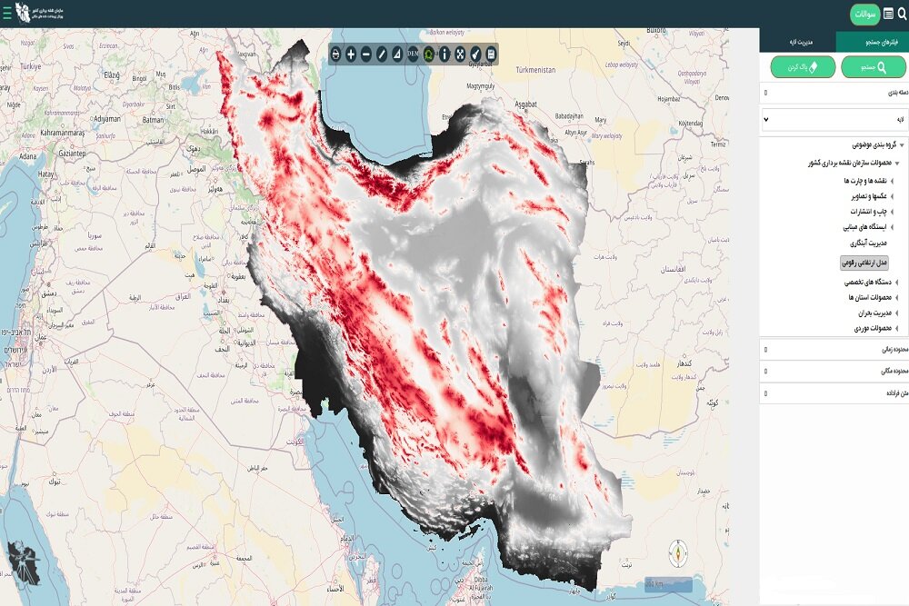
نقشهبرداری ارتفاعی ایران دیجیتالی شد/دسترسی رایگان در ژئوپرتال ملی
Warning: Undefined array key "key_ray" in /home/jbcmyqss/domains/khabaraani.ir/public_html/include/smarty/sysplugins/smarty_internal_templatebase.php(157) : eval()'d code on line 133
Warning: Attempt to read property "value" on null in /home/jbcmyqss/domains/khabaraani.ir/public_html/include/smarty/sysplugins/smarty_internal_templatebase.php(157) : eval()'d code on line 133
Warning: Undefined array key "key_ray_red" in /home/jbcmyqss/domains/khabaraani.ir/public_html/include/smarty/sysplugins/smarty_internal_templatebase.php(157) : eval()'d code on line 133
Warning: Attempt to read property "value" on null in /home/jbcmyqss/domains/khabaraani.ir/public_html/include/smarty/sysplugins/smarty_internal_templatebase.php(157) : eval()'d code on line 133
از سوی سازمان نقشهبرداری کشور دسترسی کاربران به وب سرویس مدل ارتفاعی رقومی کشور از طریق ژئوپرتال ملی فراهم شد. به گزارش ایسنا، وب سرویس مدل ارتفاعی رقومی کشور (DEM) از طریق بستر ژئوپرتال ملی در دسترس کاربران قرار گرفت. این وب سرویس، از سوی اداره تحلیلهای مکان مبنای سازمان نقشهبرداری با استفاده از افزونه ImagePyramid در زونهای مختلف در نرمافزار Geoserver ایجاد شده و به صورت سرویس wms در ژئوپرتال ملی منتشر شده است. به نقل از روابط عمومی سازمان نقشهبرداری کشور، این وب سرویس در راستای تعامل و همکاریهای مشترک سازمان نقشهبرداری و سازمان هواشناسی کشور، به درخواست معاونت توسعه، پیشبینی و مدیریت بحران سازمان هواشناسی کشور ایجاد شده و از طریق ژئوپرتال ملی به آدرس https://iransdi.ncc.gov.ir/layersf با عنوان (مدل ارتفاعی رقومی) ذیل محصولات سازمان نقشهبرداری کشور قابل دسترس...



Warning: Undefined array key "term" in /home/jbcmyqss/domains/khabaraani.ir/public_html/include/smarty/sysplugins/smarty_internal_templatebase.php(157) : eval()'d code on line 28
Warning: Attempt to read property "value" on null in /home/jbcmyqss/domains/khabaraani.ir/public_html/include/smarty/sysplugins/smarty_internal_templatebase.php(157) : eval()'d code on line 28

دوستان ما